Chertsey Meads
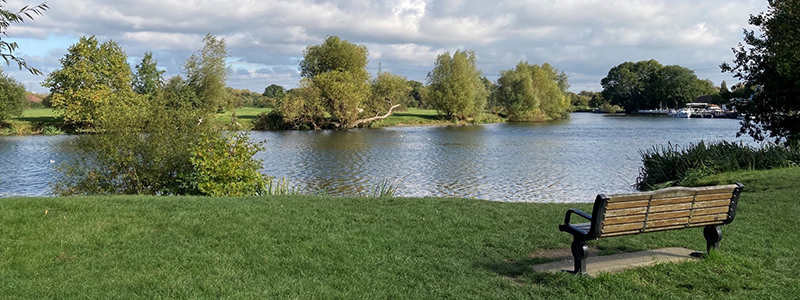
Chertsey Meads, Chertsey is an open space popular with families and dog walkers. The site extends to just over 73 hectares (180 acres) and is Runnymede's largest SANG. Meadow walking at its best, with wetland, ponds, open water, bankside vegetation and woodland also to discover. The name 'Mead' is an old word for meadow, and in 1859, 'The Book of The Thames' claimed that the site produced "the best hay in England". There are gorgeous views of the River Thames which forms much of the boundary to the north and east and the River Bourne flows along the southern boundary.
Chertsey Meads is managed as Suitable Alternative Natural Greenspace in order to create an enjoyable natural environment for recreation, away from the Thames Basin Heaths Special Protection Area.
Given the location of Chertsey Meads alongside the rivers, the site can be rather wet or even under water at times. Please choose suitable footwear to explore all areas of the site.
Facilities
Two good sized car parks with free parking allow easy access for those coming from further afield. There's a large play area near the first car park with an eye-catching boat called the Maid of The Meads to explore. Both car parks have surfaced paths linking them to Thames side picnic benches.
How to get to Chertsey Meads
By car
The site is accessed at the end of Mead Lane, Chertsey, nearest postcode is KT16 8PA. To view the roadway entrance to the site, visit the what3words website The height barrier is set at 2.1m. Although this barrier can be opened remotely, there is no public parking available beyond this point for vehicles 2.1 metres high or taller. Both car parks offer free parking and have dedicated disabled parking bays.
By foot and bike
Chertsey Meads can be accessed on foot at numerous locations. The most northerly access point is via the footbridge at the end of Bridge Wharf, opposite The Boat House Public House, Public Right of Way FP51. Towards the south, access from Addlestone Moor is via FP8.
Further to the east, the Meads can be accessed via FP9. There's also a pavement running the length of Mead Lane. For cyclists, National Cycle Network Route 4 passes across the site.
By public transport
The closest rail station is Chertsey at 1.7km. Addlestone is slightly further away at 1.8km. Please visit the Surrey County Council - Bus timetables for up-to-date details on bus routes and services.
Nature and wildlife
There is a detailed management plan in place to guide the management of the site in order to enhance biodiversity. The grassland supports many rare and beautiful species. Calcium carbonate deposited by floodwaters has been a factor in creating the unusual grassy sward found here with several species that are normally found in chalky regions. The current management of the grassland involves an annual meadow cut with the arisings removed. Cuttings left on site would cause soil enrichment, smother plants and prevent seeds from germinating. Certain areas are mown on a more regular basis to allow for easier visitor access. The wetland area on site is one of the few areas which avoided ploughing or enrichment in the past and now supports a number of notable plant, bird and invertebrate species. This area needs careful rotational management to create a varied structure which will benefit birds such as the Reed Bunting while preventing the Common Reed from completely taking over the reed bed to the detriment of other plants.
This form helps us improve the content and structure of our webpages only, and we cannot provide a response to any submission below.